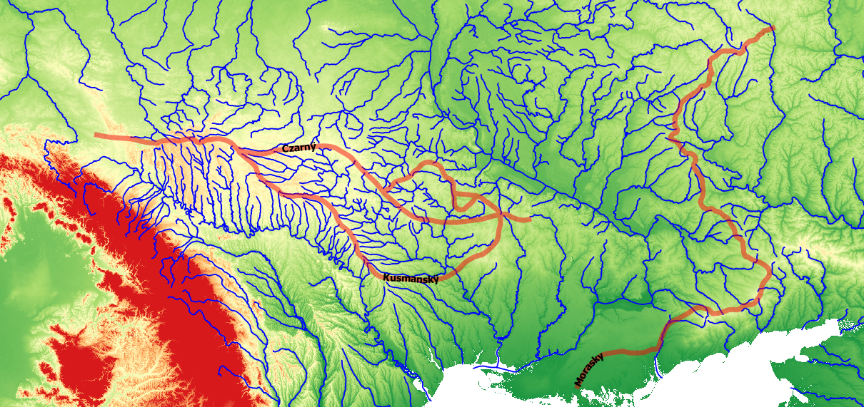
Szlak, a Polish word meaning "trail," was the name given to paths used to traverse the Pontic Steppe in the early modern period. Regular roads were virtually non-existent, and overland travel tended to follow general paths that conducted travelers between destinations as expeditiously as possible, avoiding terrain such as mountains, ravines, and difficult river crossings. The BSZLAK project attempts to trace the paths of three of these trails: the Czarny szlak, the Kuszmansky szlak, and the Morasky szlak, which were of particular importance to the Black Sea slave trade that saw the abduction or death of some two million individuals from the region from 1500-1700. The primary sources used to trace these paths are fifteen maps by Guillaume Le Vasseur de Beauplan produced in the mid-1600s. Beauplan's maps show populated places, rivers, river fords, river rapids, forests, mountains, and valleys that can be associated with places shown on modern maps, thereby providing landmarks for tracing szlak paths.
Databases
BSZLAK-Czarny-KML, Mark Polczynski and Michael Polczynski
BSZLAK-Czarny-SHP, Mark Polczynski and Michael Polczynski
BSZLAK-Kuszmansky-KML, Mark Polczynski and Michael Polczynski
BSZLAK-Kuszmansky-SHP, Mark Polczynski and Michael Polczynski
BSZLAK-Morasky-KML, Mark Polczynski and Michael Polczynski
BSZLAK-Morasky-SHP, Mark Polczynski and Michael Polczynski
Documentation
BSZLAK-Description, Mark Polczynski and Michael Polczynski