Introduction
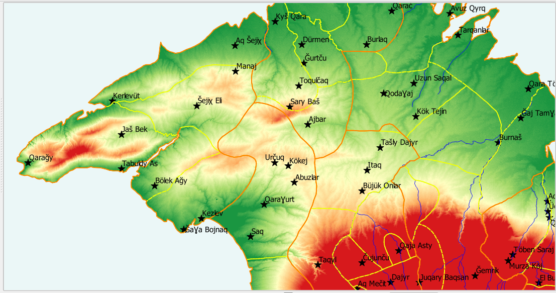
Henryk Jankowski’s historical-etymological dictionary of pre-Russian habitation names in Crimea contains toponyms of approximately 1,300 unique habitations that existed in this region prior to Russian annexation in 1783. The Historical Gazetteer of Crimea (HGC) is an open-access georeferenced gazetteer of historical places derived from Jankowski’s work. The HGC includes 135 habitations, 43 districts, 6 provinces, and 17 rivers shown on Jankowski’s map accompanying his book.
HGC materials are available through a Marquette University repository. Here we provide an overview of the HGC and the associated repository, starting with a review of the information sources used to create the gazetteer, followed by descriptions of the general HGC dataset format and the habitation, district, and province datasets.
Description of HGC support datasets contained in this repository are then provided, followed by directions on how to access the dataset. Finally, advantages of associating gazetteer places with the GeoNames database are discussed.
The authors encourage students, researchers, and the public to use HGC materials in their investigations of this historically and currently critical region of the world. To this end, all HGC materials are being made available through a Creative Commons CC0 1.0 Universal Public Domain Dedication license. For geographers and historians in general, the HGC also provides an example of an approach to creating an open-access georeferenced gazetteer of historical places.
Link to full introductionArticles
Introduction to the Historical Gazatteer of the Crimea (HGC) Repository, Mark Polczynski and Michael Polczynski
Databases
HGC-KML, Michael Polczynski and Mark Polczynski
HGC-SHP, Michael Polczynski and Mark Polczynski
HGC-TXT, Michael Polczynski and Mark Polczynski
Documentation
HGC-Description, Michael Polczynski and Mark Polczynski
Tools
HGC-QGIS-Quick-Start, Michael Polczynski and Mark Polczynski